
ⴰⴼⴰⵢⵍⵓ:Tamazgha map.png
ⵜⵉⴷⴷⵉ ⵏ ⵜⵎⵓⵖⵍⵉ ⴰⴷ: 600 × 600 ⵉⴷ ⴱⵉⴽⵙⵍ. ⵜⵉⴼⵙⴰⵢⵉⵏ: ⵢⴰⴹⵏ 240 × 240 ⵉⴷ ⴱⵉⴽⵙⵍ | 480 × 480 ⵉⴷ ⴱⵉⴽⵙⵍ | 768 × 768 ⵉⴷ ⴱⵉⴽⵙⵍ | 1 024 × 1 024 ⵉⴷ ⴱⵉⴽⵙⵍ | 2 048 × 2 048 ⵉⴷ ⴱⵉⴽⵙⵍ.
ⴰⴼⴰⵢⵍⵓ ⴰⵙⴰⵍⴰⵏ (2 048 × 2 048 ⵉⴷ ⴱⵉⴽⵙⵍ, ⵜⵉⴷⴷⵉ ⵏ ⵓⴼⴰⵢⵍⵓ: 493 KB, ⴰⵏⴰⵡ MIME: image/png)

|
This map image could be re-created using vector graphics as an SVG file. This has several advantages; see Commons:Media for cleanup for more information. If an SVG form of this image is available, please upload it and afterwards replace this template with
{{vector version available|new image name}}.
It is recommended to name the SVG file “Tamazgha map.svg”—then the template Vector version available (or Vva) does not need the new image name parameter. |
ⴰⵙⴳⵣⵍ
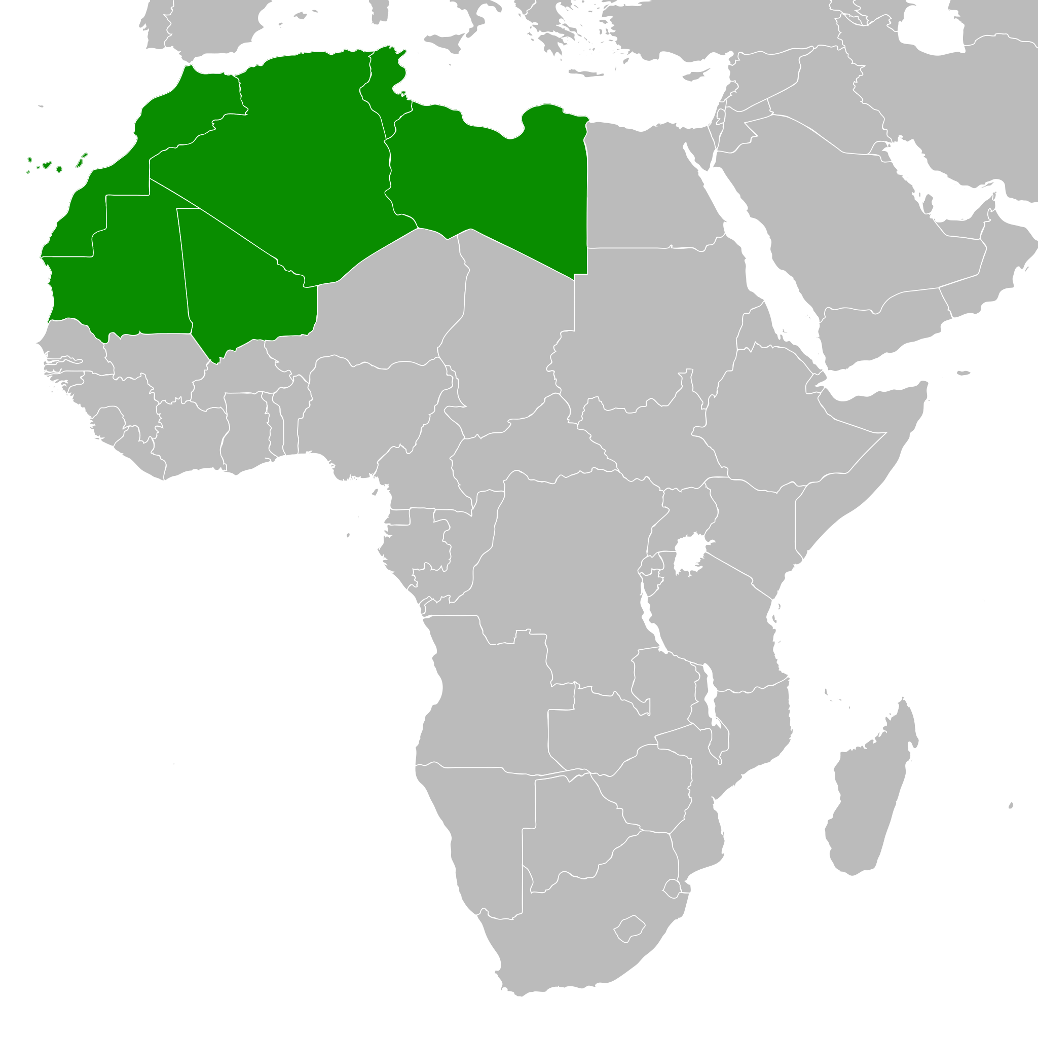
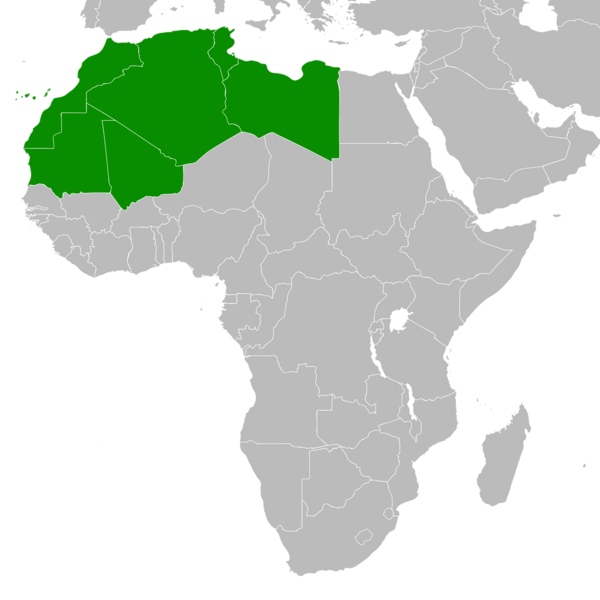
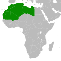
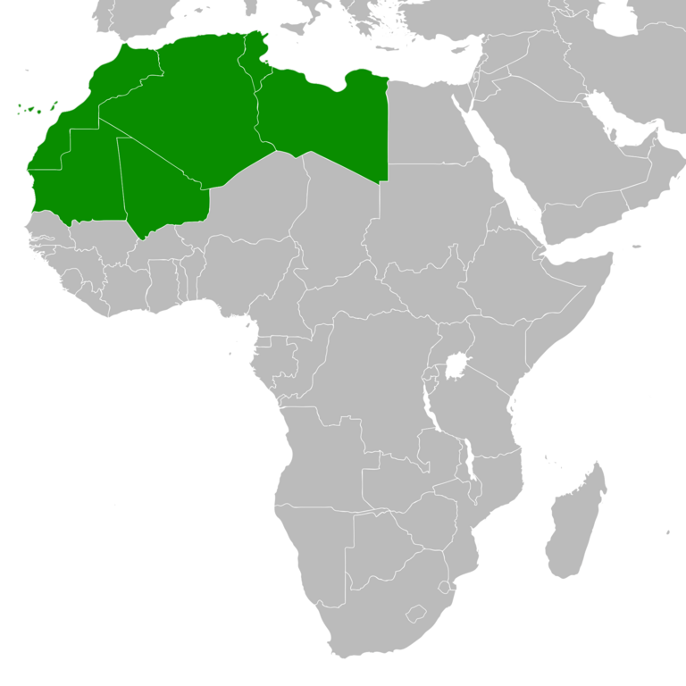
| ⴰⴳⵍⴰⵎ | The Amazigh Tamazgha area — of North and West Africa. |
| ⴰⵙⴰⴽⵓⴷ | |
| ⴰⵙⴰⴳⵎ | ⵜⴰⵡⵡⵓⵔⵉ ⵜⴰⵏⵉⵎⴰⵏⵜ (Original text: self-made, already in it.wiki) |
| ⴰⵎⴳⴰⵢ | Vermondo |
ⵜⵓⵔⴰⴳⵜ
Vermondo, the copyright holder of this work, hereby publishes it under the following licenses:

|
ⵖⵓⵔⴽ ⵜⵓⵔⴰⴳⵜ ⵏ ⴰⴷ ⵜⵙⵙⵏⵖⵍⴷ, ⴰⴷ ⵜⴱⴹⵓⴷ ⴷ ⴰⴷ ⵜⵙⵏⴼⵍⴷ ⵜⴰⵏⵜⴰⵎⵜ ⴰⴷ ⴷⴷⵓ ⵜⴼⴰⴷⵉⵡⵉⵏ ⵏ ⵜⵓⵔⴰⴳⵜ ⵊⵉⵏⵓ ⵉ ⵜⵏⵜⴰⵎⵉⵏ ⵜⵉⵍⴻⵍⵍⵉⵢⵉⵏ ⵜⵓⵏⵖⵉⵍⵜ 1.2 ⵏⵖ ⵜⵓⵏⵖⵉⵍⵜ ⵜⴰⵎⴰⵢⵏⵓⵜ ⴰⴽⴽ ⵏⵏⴰ ⵜⵥⵔⴳ ⵜⴰⵎⵔⵙⵍⵜ ⵏ ⵉⵙⵓⴼⵜⵡⵓⵔⵏ ⵉⵍⴻⵍⵍⵉⵢⵏ, ⵎⵉⵏ ⵜⵉⵣⵓⵏⵉⵡⵉⵏ ⴰⵔⵎⵙⴽⵉⵍⵏ, ⵎⵉⵏ ⴰⴹⵔⵉⵙ ⵏ ⵜⴰⵙⵏⴰ ⵜⴰⵎⵣⵡⴰⵔⵓⵜ ⵏ ⵜⴷⵓⵍⵉ ⴷ ⵎⵉⵏ ⴰⴹⵔⵉⵙ ⵏ ⵜⴰⵙⵏⴰ ⵜⴰⵎⴳⴳⴰⵔⵓⵜ ⵏ ⵜⴷⵓⵍⵉ.ⵢⴰⵜ ⵜⵓⵏⵖⵉⵍⵜ ⵏ ⵜⵓⵔⴰⴳⵜ ⵜⴽⵛⵎ ⴳ ⵜⵣⵓⵏⵉ ⵉⵍⴰⵏ ⴰⵣⵡⵍ GNU Free Documentation License. |
| ⴰⴼⴰⵢⵍⵓ ⴰⴷ ⵉⵍⵍⴰ ⴷⴷⵓ ⵜⴼⴰⴷⵉⵡⵉⵏ ⵏⵜⵓⵔⴰⴳⵜ Creative Commons Attribution - Partage dans les Mêmes Conditions 3.0 (non transposée). | ||
| ⵜⵉⵡⵓⵔⵉⵡⵉⵏ: Vermondo | ||
| ||
| This licensing tag was added to this file as part of the GFDL licensing update. |
This file is licensed under the Creative Commons Attribution-Share Alike 2.5 Generic, 2.0 Generic and 1.0 Generic license.
ⵜⵉⵡⵓⵔⵉⵡⵉⵏ: Vermondo
- ⵜⴳⵉⴷ ⵉⵍⴻⵍⵍⵉ:
- ⴱⴹⵓ – ⵉ ⵓⵙⵙⵏⵖⵍ, ⴰⴱⵟⵟⵓ ⴷ ⵓⵙⵎⵓⵜⵜⵢ ⵏ ⵜⵡⵓⵔⵉ
- ⵛⵛⴰⵔ – ⵉ ⵓⵙⵎⵙⴰⵙⴰ ⵏ ⵜⵡⵓⵔⵉ
- ⴷⴷⴰⵡ ⵜⴼⴰⴷⵉⵡⵉⵏ ⴰⴷ:
- ⴰⵎⴰⵙ – ⵉⵇⵇⴰⵏ ⴷ ⴰⴷ ⵜⴼⴽⴷ ⵓⵎⵍⴰⵏ ⵖⴼ ⵓⵎⴳⴰⵢ, ⵜⴼⴽⴷ ⴰⵙⵖⵏ ⵖⵔ ⵜⵓⵔⴰⴳⵜ, ⵜⵎⵍⴷ ⵉⵖ ⵉⵜⵜⵡⴰⵙⵏⴼⵍ. ⵜⵣⴹⴰⵔⴷ ⴰⴷ ⵜⵙⴽⵔⴷ ⵎⴽ ⴰⴷ ⵙ ⵜⵖⴰⵔⴰⵙⵜ ⵏⵏⴰ ⴷ ⵢⵓⵙⴰⵏ, ⵎⴰⵛ ⵓⵔ ⴷ ⴽⵔⴰ ⵏ ⵜⵖⴰⵔⴰⵙⵜ ⵉⵎⵎⴰⵍⵏ ⵎⴰ ⵙ ⴷ ⴰⵎⴳⴰⵢ ⴰⵔ ⴽ ⵉⵏⵏⴰⵍ ⵏⵖ ⴷ ⴰⵙⵎⵔⵙ ⵏⴽ.
- ⴱⴹⵓⵜ ⵎⴽⵍⵍⵉⵜ – ⵎⴽ ⵜⵙⵏⴼⵍⴷ ⵏⵖ ⵜⵙⵎⵓⵜⵜⵉⴷ ⵏⵖ ⵜⵥⴽⵉⴷ ⵖⴼ ⵜⵡⵓⵔⵉ, ⵉⵇⵇⴰⵏⴽ ⵉⴷ ⴰⴷ ⵜⴱⴹⵓⴷ ⵜⵓⵎⵓⵜⵉⵏ ⵏⴽ ⴷⴷⴰⵡ ⵜⵓⵔⴰⵇⵜ ⴰⵏⵏ ⵏⵉⵜ ⵏⵖ ⴽⵔⴰ ⵏ ⵜⵓⵔⴰⴳⵜ ⴷ ⵢⵓⵙⴰⵏ ⴷ ⵜⴷⵙⵍⴰⵏⵜ.
ⵜⵣⵎⵔⴷ ⴰⴷ ⵜⵙⵜⵉⴷ ⵜⵓⵔⴰⴳⵜ ⵏⵏⴰ ⵜⵔⵉⴷ.
ⴰⵎⵣⵔⵓⵢ ⵏ ⵓⴼⴰⵢⵍⵓ
ⴽⵍⵉⴽⵉ ⵖⴼ ⵓⵙⴰⴽⵓⴷ/ⴰⴽⵓⴷ ⵃⵎⴰ ⴰⴷ ⵜⵙⴽⵏⴷ ⴰⴼⴰⵢⵍⵓ ⵎⴰⵏⵎⴽ ⴰⴷ ⵢⴰⴷⵍⵍⵉ ⵉⴳⴰ ⴳ ⵡⴰⴽⵓⴷ ⴰⵏⵏ.
| ⴰⵙⴰⴽⵓⴷ/ⴰⴽⵓⴷ | ⵜⴰⵡⵍⴰⴼⵜ ⵎⵥⵥⵉⵢⵏ | ⵉⵎⵏⴰⴷⵏ | ⴰⵏⵙⵙⵎⵔⵙ | ⴰⵖⴼⴰⵡⴰⵍ | |
|---|---|---|---|---|---|
| ⴰⵎⵉⵔⴰⵏ | 16:20, 17 ⵛⵓⵜⴰⵏⴱⵉⵔ 2023 | | 2 048 × 2 048 (493 KB) | ⵣⵉⵔⵉ ⴰⵎⵖⵏⴰⵙ | Add new version |
| 16:30, 17 ⵎⴰⵕⵚ 2018 |  | 360 × 392 (10 KB) | Maphobbyist | Montenegro border | |
| 19:44, 9 ⵢⵓⵍⵢⵓⵣ 2011 |  | 360 × 392 (13 KB) | Maphobbyist | South Sudan has become independent on July 9, 2011. Sudan and South Sudan are shown with the new international border between them. | |
| 14:53, 7 ⵎⴰⵢⵢⵓ 2007 |  | 360 × 392 (14 KB) | Vermondo | {{Information |Description=The Tamazgha area (Northern Africa |Source=self-made, already in it.wiki |Date=March 2006 |Author= User:Vermondo }} |
ⴰⵙⵎⵔⵙ ⵏ ⵓⴼⴰⵢⵍⵓ
ⵜⴰⵙⵏⴰ ⴰⴷ ⵜⵙⵎⵔⵙ ⴰⴼⴰⵢⵍⵓ ⴰⴷ:
ⴰⵙⵎⵔⵙ ⴰⵖⵣⵓⵔⴰⵏ ⵏ ⵓⴼⴰⵢⵍⵓ
ⵉⵡⵉⴽⵉⵜⵏ ⴰⴷ ⵢⴰⴹⵏⵉⵏ ⴰⵔ ⵙⵙⵎⵔⵙⵏ ⴰⴼⴰⵢⵍⵓ ⴰⴷ:
- ⴰⵙⵎⵔⵙ ⴳ incubator.wikimedia.org
- ⴰⵙⵎⵔⵙ ⴳ shi.wikipedia.org