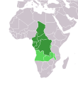
ⴰⴼⴰⵢⵍⵓ:Africa-countries-central.svg
ⵜⵉⴼⵔⴰⵙ

Size of this PNG preview of this SVG file: 384 × 420 ⵉⴷ ⴱⵉⴽⵙⵍ. ⵓⴱⵓⵢⵏ ⵢⴰⴹⵏⵉⵏ: 219 × 240 ⵉⴷ ⴱⵉⴽⵙⵍ | 439 × 480 ⵉⴷ ⴱⵉⴽⵙⵍ | 702 × 768 ⵉⴷ ⴱⵉⴽⵙⵍ | 936 × 1 024 ⵉⴷ ⴱⵉⴽⵙⵍ | 1 872 × 2 048 ⵉⴷ ⴱⵉⴽⵙⵍ.
ⴰⴼⴰⵢⵍⵓ ⴰⵙⴰⵍⴰⵏ (ⴰⴼⴰⵢⵍⵓ SVG, ⵙ 384 × 420 ⵉⴷ ⴱⵉⴽⵙⵍ, ⵜⵉⴷⴷⵉ ⵏ ⵓⴼⴰⵢⵍⵓ: 26 KB)
ⴰⵎⵣⵔⵓⵢ ⵏ ⵓⴼⴰⵢⵍⵓ
ⴽⵍⵉⴽⵉ ⵖⴼ ⵓⵙⴰⴽⵓⴷ/ⴰⴽⵓⴷ ⵃⵎⴰ ⴰⴷ ⵜⵙⴽⵏⴷ ⴰⴼⴰⵢⵍⵓ ⵎⴰⵏⵎⴽ ⴰⴷ ⵢⴰⴷⵍⵍⵉ ⵉⴳⴰ ⴳ ⵡⴰⴽⵓⴷ ⴰⵏⵏ.
| ⴰⵙⴰⴽⵓⴷ/ⴰⴽⵓⴷ | ⵜⴰⵡⵍⴰⴼⵜ ⵎⵥⵥⵉⵢⵏ | ⵉⵎⵏⴰⴷⵏ | ⴰⵏⵙⵙⵎⵔⵙ | ⴰⵖⴼⴰⵡⴰⵍ | |
|---|---|---|---|---|---|
| ⴰⵎⵉⵔⴰⵏ | 19:20, 12 ⴷⵓⵊⴰⵏⴱⵉⵔ 2023 |  | 384 × 420 (26 KB) | ReneeWrites | Uploaded a work by ReneeWrites from {{derived from|Africa-countries-blank.svg}} with UploadWizard |
ⴰⵙⵎⵔⵙ ⵏ ⵓⴼⴰⵢⵍⵓ
ⵜⴰⵙⵏⴰ ⴰⴷ ⵜⵙⵎⵔⵙ ⴰⴼⴰⵢⵍⵓ ⴰⴷ:
ⴰⵙⵎⵔⵙ ⴰⵖⵣⵓⵔⴰⵏ ⵏ ⵓⴼⴰⵢⵍⵓ
ⵉⵡⵉⴽⵉⵜⵏ ⴰⴷ ⵢⴰⴹⵏⵉⵏ ⴰⵔ ⵙⵙⵎⵔⵙⵏ ⴰⴼⴰⵢⵍⵓ ⴰⴷ:
- ⴰⵙⵎⵔⵙ ⴳ af.wikipedia.org
- ⴰⵙⵎⵔⵙ ⴳ am.wikipedia.org
- ኢትዮጵያ
- አፍሪቃ
- ሱዳን
- ኬንያ
- ናይጄሪያ
- ግብፅ
- መለጠፊያ:በአፍሪካ ውስጥ የሚገኙ አገሮች
- አንጎላ
- ማላዊ
- ሊቢያ
- ናሚቢያ
- ኤርትራ
- ላይቤሪያ
- አልጄሪያ
- ኤስዋቲኒ
- ካሜሩን
- ሞዛምቢክ
- ካቦ ቨርዴ
- ታንዛኒያ
- ቡርኪና ፋሶ
- ሞሮኮ
- ቻድ
- ደቡብ አፍሪካ
- ሞሪታኒያ
- ምዕራባዊ ሣህራ
- ዩጋንዳ
- ሴኔጋል
- የመካከለኛው አፍሪካ ሪፐብሊክ
- ቦትስዋና
- ጋና
- ዛምቢያ
- ጋቦን
- ዚምባብዌ
- ማዳጋስካር
- ኮንጎ ዲሞክራሲያዊ ሪፐብሊክ
- ኮንጎ ሪፐብሊክ
- ማሊ
- ሩዋንዳ
- ቤኒን
- ጅቡቲ
- ጊኔ-ቢሳው
- ሶማሊያ
- ሌሶቶ
- ጋምቢያ
- ቶጎ
- ቡሩንዲ
- ቱኒዚያ
- ኒጄር
- ሞሪሸስ
ⵙⴽⵏ ⵓⴳⴳⴰⵔ ⵖⴼ ⵓⵙⵙⵎⵔⵙ ⴰⵎⴰⵜⴰⵢ ⵏ ⵓⴼⴰⵢⵍⵓ ⴰⴷ.


